Bhakra Dam
Bhakra Dam
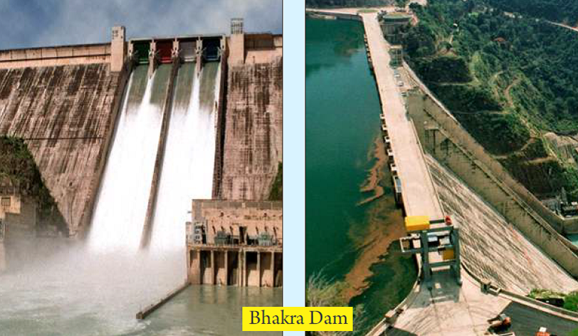
Overview of the Dam
- Around 226 m high and 518 m long, Bhakra dam is the 2nd highest dam in India after the Tehri dam. It is also the highest straight gravity dam in the world.
- Bhakra dam is constructed on Satluj river and located in Himachal Pradesh and Punjab border near Nangal city.
- It is intended for irrigation as well as hydro-electric purposes.
- The installed capacity of Bhakra Right Bank Power House is 785 MW (5x157 MW) and that of Bhakra Left Bank Power House is 594 MW (3x126 MW + 2x10⁸MW).
- The construction of dam was completed in 1963.
- Operation and Maintenance of the Bhakra dam is done by Bhakra Beas Management Board (BBMB).
- Bhakra dam is straight gravity cum concrete dam having four spillway radial gates with designed spillway capacity of 8212 cumec.
- The Gobind Sagar reservoir of the dam has gross storage capacity of 9621 Million Cubic Meter (MCM) and effective storage capacity of 7192 MCM.
Sutlej river
The Sutlej river originates in China in Western Tibet in the Kailas mountain range and near the source of the rivers Indus, Ganges and Brahmaputra. The river is 1 536 km long and has a catchment area of 75 369 km2 (of which 70 percent is in India). It flows into Pakistan (Punjab) near Ferozepur and eventually joins the Chenab river close to Punjnad barrage. The Sutlej river has eight major tributaries (all except Rohi Nullah join Sutlej river in India). The largest tributary is the Beas river, which is 464 km long and with a catchment area of 9 920 km2 (NDMA-UNDP, 2010).
The River Sutlej enters India near Mansarover and flows North Westwards. It crosses great Himalayan ranges on its way from the Shipkipass. It flows upto Gobind Sagar Lake over which Bhakra dam is constructed. About 14 Kms. downstream of Bhakra dam, Nangal head-works are constructed at Nangal. From here onwards, the river takes southern direction. After flowing for another about 50 kms, it enters the plains near Ropar. It finally reaches Harike where it meets river Beas. During the monsoon period, the areas on both sides of river are prone to floods.
Sources:
Last Modified : 9/14/2023
This topic provides information about Tehri Dam.
This topic provides information about Tuirial Dam,...
This topic provides information about the Doyang D...
This topic provides information about the Ranganad...